Note: This research-based guide was prepared with AI assistance. No site visits or hands-on tests were conducted. Please verify all local regulations and accessibility requirements directly with official tourism boards before your travel dates.
Historic cities are often the most coveted destinations on a traveler’s list, yet they frequently present the most significant logistical hurdles. The very qualities that draw us to places like Old Québec or Kyoto—their preserved architecture, ancient street layouts, and deeply rooted traditions—are often the same features that make them difficult to navigate for travelers with reduced mobility or those seeking a seamless, stress-free experience. Successfully visiting these destinations requires moving beyond the standard guidebook and engaging in a research-based planning process that prioritizes local infrastructure and community etiquette.
Understanding Vertical Geography in Old Québec
Old Québec is a city defined by its topography. As a UNESCO World Heritage site, its layout was determined centuries ago, resulting in a distinct division between Upper Town and Lower Town. For travelers with reduced mobility, this verticality is the primary logistical challenge. The two districts are connected by steep slopes and a flurry of stairs, which can render standard navigation plans ineffective.
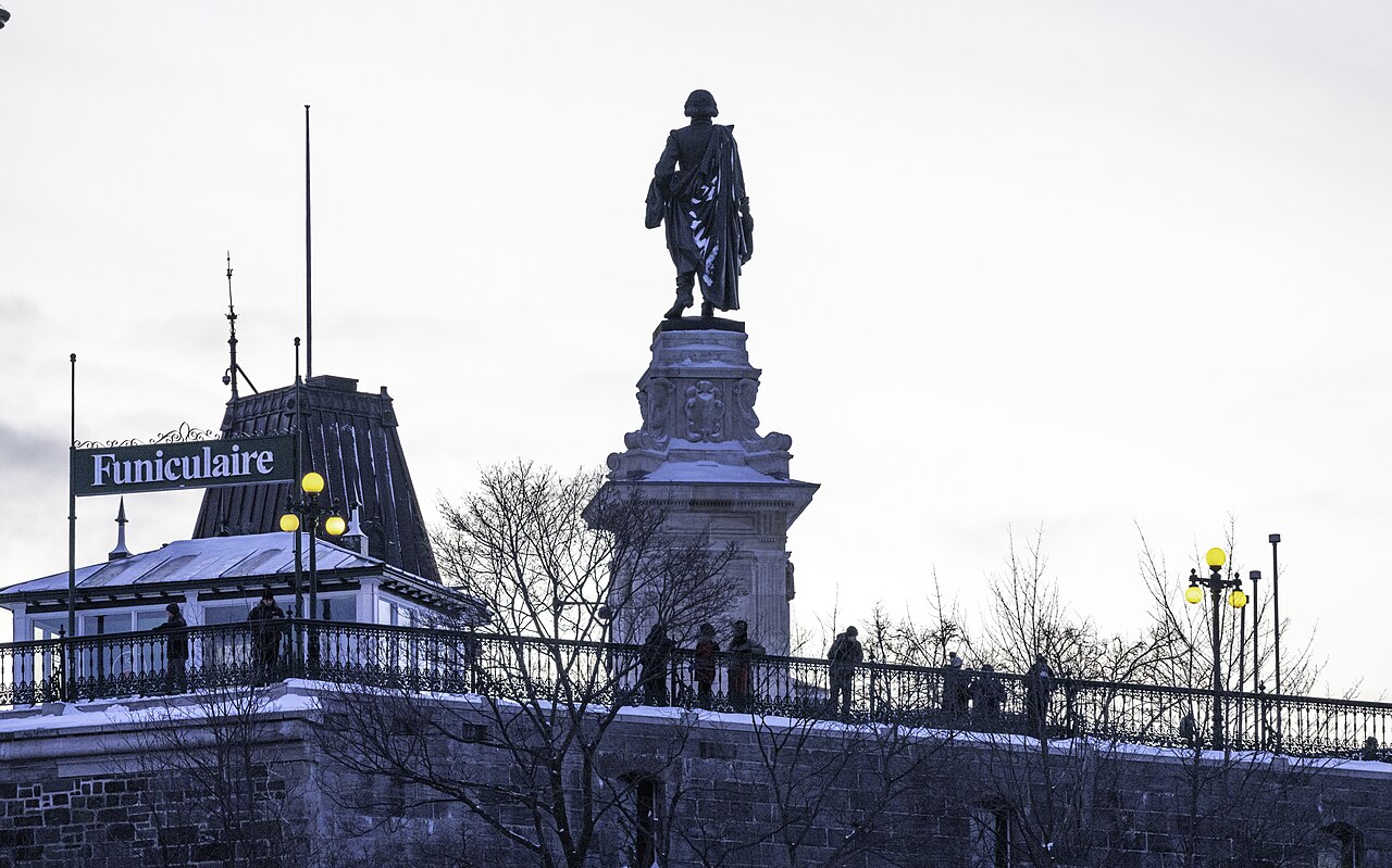
The cobblestone streets of the Petit-Champlain and Place-Royale districts in Lower Town offer immense character but can be difficult for manual wheelchair users or those sensitive to vibrations. If you are planning a trip, the most effective strategy is to plan a step-free city trip by grouping your sightseeing by district. Attempting to traverse between the river level and the cliff-top fortifications repeatedly throughout the day is rarely efficient. Instead, focus on one area at a time. The free, wheelchair-accessible funicular is an essential piece of infrastructure that connects Petit-Champlain and the Dufferin Terrace, providing a critical transit link that bypasses the most strenuous inclines.
For transportation, public transit users should note that the RTC (public transit) buses on high-frequency routes—such as lines 800, 801, 802, 803, 804, and 807—are equipped with access ramps. However, the system requires that passengers be able to board and exit on their own. For travelers requiring paratransit, the STAC service is available, though it necessitates a reservation 24 hours in advance. To build a reliable itinerary, consult the Quebec for All database, which provides a verified list of tourism businesses, hotels, and attractions that have been vetted for accessibility.
Kyoto: Respect and Infrastructure in a Living City
In Kyoto, the challenges of accessibility and congestion are inextricably linked to the city’s status as a living, breathing community. Unlike cities that function primarily as museums, Kyoto’s historic sites are often tucked into quiet residential areas. This requires a different kind of preparation: one that balances the visitor’s desire to see the sights with the residents’ right to privacy and peace.
Responsible travel in Kyoto begins with understanding the city’s guidelines. The Kyoto Travel guidelines emphasize that tourism should enrich the lives of residents. This means adhering strictly to local etiquette: do not stop, touch, or photograph geiko or maiko without permission, and respect “no photography” zones in private alleys and temples. These rules are not mere suggestions; they are essential for preserving the neighborhood’s integrity.
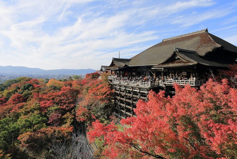
Logistically, the city provides excellent digital tools to help manage your itinerary. The Kyoto Travel Congestion Forecast is a vital resource for any traveler. By using live cameras and data, this tool helps you avoid overcrowding at popular locations like Kiyomizudera Monzen or Arashiyama. Planning your day around these congestion forecasts allows you to visit major sites during quieter windows, which not only improves your experience but also reduces the strain on local infrastructure. Before booking your accommodation, take time to how to verify an accessible hotel room to ensure that the facility meets your specific needs, as architectural constraints in historic districts can make universal accessibility a complex standard to meet.
A Framework for Responsible Urban Exploration
Whether you are in a North American historic district or an ancient Asian capital, the principles of responsible and efficient travel remain consistent. Use the following framework to guide your planning:
- Verify Topography and Transit: Before booking, research the specific accessibility of your destination’s transit. Does the city offer a paratransit service? Are there steep grades that require a specific route?
- Utilize Official Data: Rely on official tourism board resources—such as the Quebec for All database or the Kyoto Travel Congestion Forecast—rather than general travel forums, which may contain outdated or anecdotal information.
- Respect the Residential Boundary: In cities where tourism and daily life overlap, prioritize quiet, respectful behavior. Avoid private property, follow local signage, and use public transit instead of unlicensed private vehicles.
- Plan for Recovery Time: Navigating historic cities is physically and mentally demanding. Build “open days” or flexible time into your itinerary to account for the extra effort required to navigate uneven streets or crowded districts.
By shifting your focus from a checklist of sights to a logistical understanding of the city’s physical and social landscape, you ensure that your visit is not only more manageable for you but also more sustainable for the destination. A thoughtful approach acknowledges that we are guests in these spaces, and our goal should be to experience them without leaving a negative impact on the daily lives of those who call them home.
Representative photo showing the funicular entrance, a critical piece of infrastructure for navigating the vertical topography of Old Quebec. Photo: Wilfredor / Wikimedia Commons · CC0. Resized for display. Sources checked October 23, 2026.